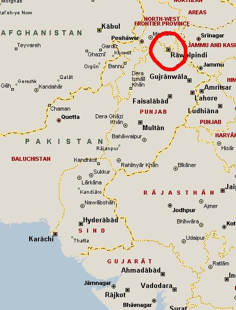
According to Microsoft Streets & Trips, Pakistan has no Capital.

Islamabad should be right there, next to Rawalpindi, but it’s not. You have to zoom way in before it becomes visible.
In defense of MS Streets & Trips, the symbol allocated to Islamabad indicates that, yes, it is the national capital, however given that Islamabad is a city of only 800,000 while Rawalpindi has 3,000,000, the maps naturally give the larger city precedence when it comes to displaying on smaller and smaller map scales. However, I think that a national capital should override any population schema. Doing some scrolling around the maps at various scales shows that this population bias is common throughout the world and is not Pakistan-centric. It’s a function of population.*
This shows how GISs can mess with your head when they’re not well thought out. Or how they can mess with your head when your expectations and desires are not the same as the people who designed the GIS in the first place.
*Although I discovered at Liberia that it’s not just population but a desire of the program to place the name of the country that keeps the capital from being displayed. Monrovia is the largest city in (and capital of) Liberia, but it doesn’t display at small scales because MS Streets & Trips insists on placing the country name approximately centered in the country borders, right where the name for Monrovia would be.
**Oh, by the way, in an extremely rare event, the map is copyright 2004 Microsoft Inc. No Creative Commons for you, Mr. Map!